Perkins Trail Hike Overview
- Length: 3.8 miles (6.11 km) round-trip
- Hiking Time: 75 minutes
- Difficulty: Moderate
- Elevation Gain: 386 feet
- Route: Loop
- Best Season: Summer. When the trail is solid, wildlife is abundant, and scenery is plentiful
- Pets Allowed: Yes (leashed)
- Kid-Friendly: Yes, for those who can hike a hilly trail.
- Wheelchair Accessible: No
- Finding the Trailhead: Located at the Everett Covered Bridge Trailhead. 2370 Everett Road, Peninsula, Ohio 44264
Perkins Trail (Cuyahoga Valley National Park)
The Perkins Trail is a 3.8-mile loop that starts at the famous Everett Covered Bridge Trailhead near the Cuyahoga River.
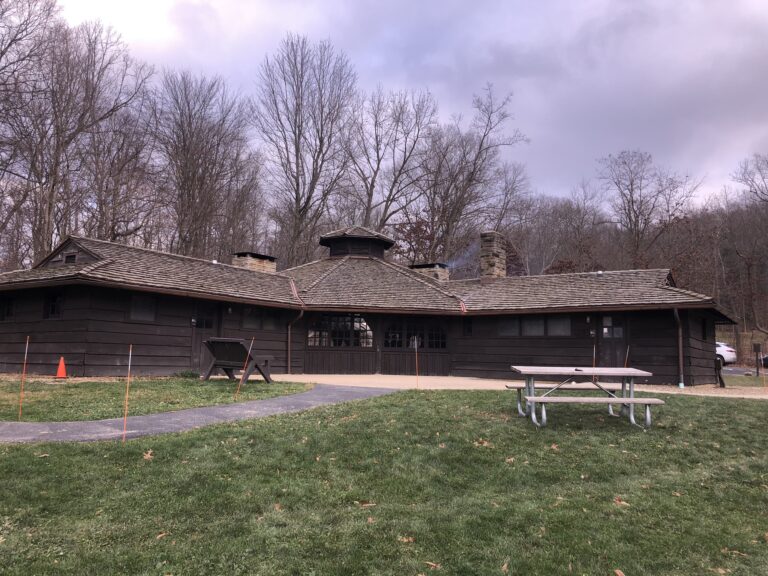
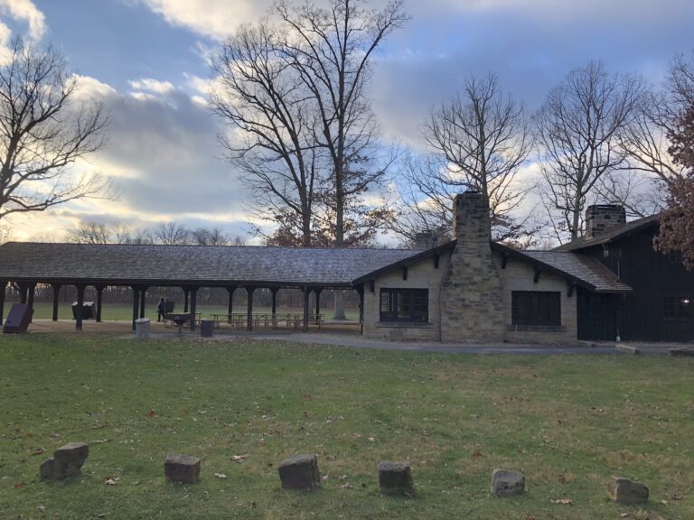
To begin, pull into the large parking lot (where there is a bathroom and park information sign) at the Everett Covered Bridge and follow the limestone trail for 100 feet before getting to the (red) Everett Covered Bridge.
You will continue through the bridge for another couple of minutes before reaching the first sign that gives you several trail options, including Perkins Trail. Take a left on Perkins Trail, where you will hike for a short period of time (1/3 mile) through a small wooded area. This is your first opportunity to spot wildlife like chipmunks, deer, and, on occasion, coyotes. You will then immediately begin your first ascent for about 1/3 mile.
As you complete your first climb, you will notice lots of wooded areas and sloping hills, making it a perfect spot to observe coyotes and deer. You will then hike for another 3/4 mile of flat, but windy trail. In this section of the trail, I’ve seen anything from hawks to owls to small mammals. You’ll also be traversing in and out of the summit metroparks.
From there, you’ll gently descend for another 1/4 mile before climbing another 1/4 mile before you reach the next intersection loop marker/sign. At this marker, you can go left or right, but to eliminate the potential to get lost or add additional mileage, I recommend taking a left.
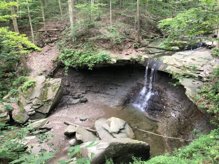
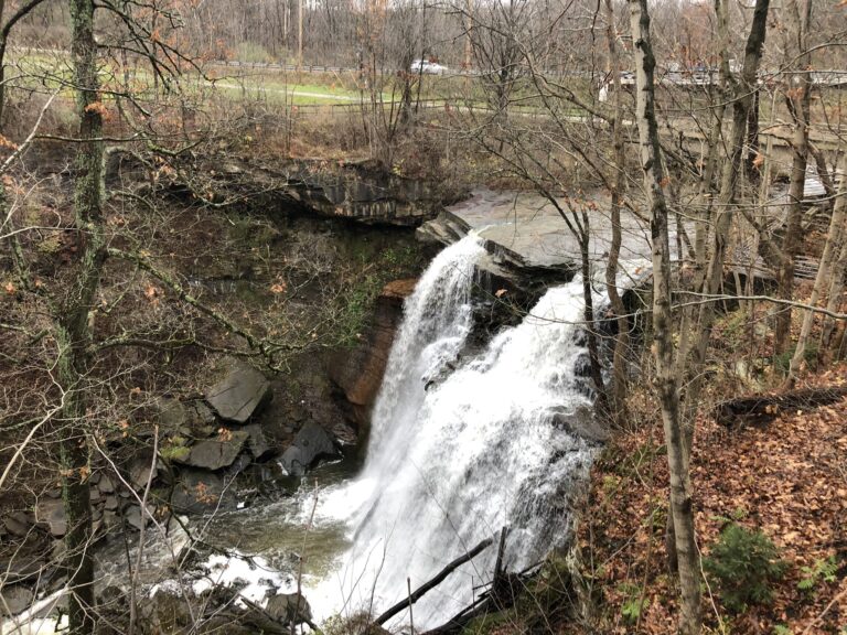
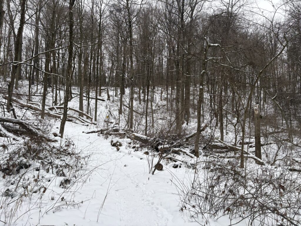
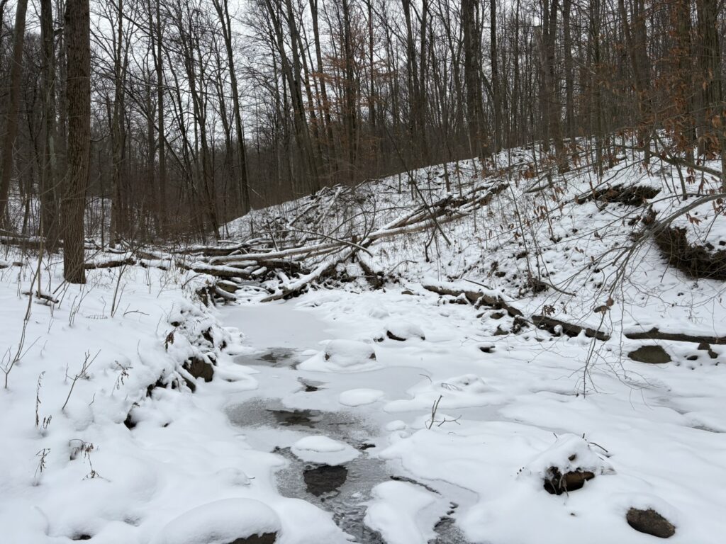
You will then hike for approximately another mile and a half, where you’ll continue to have a mix of flat and descending before you cross not one, but two beautiful creek crossings. In the winter, these creeks make the hike a surreal experience, and in the summer, they add a nice reprieve from the summer heat. Not only that, but you’ll notice this is one of the most remote sections of the park!
You’ll notice the next 3/4 of a mile is calm, quiet, and may be the most peaceful section of the trail. Expect the trail to be flat and windy, surrounded by an assortment of trees and brush. This may be your best opportunity to spot wildlife before you start reaching more of a residential section.

After you pass a couple of houses in the distance, you’ll quickly come to the intersection you started at. At this point, you’ll want to take a right, and within a couple minute,s you’ll see the Everett Covered Bridge.
You will pass back through the Everett Covered Bridge and the limestone trail that leads back to your car. Before finishing the hike, it is recommended that you take some time to learn about the park’s history and the numerous signs by the bridge. During the summer and early fall, this is also a great time to enjoy a picnic or frolic in the water below.
Alternative Option
If you want to make a full day of it in the Everett Covered Bridge area in the Cuyahoga Valley National Park or prefer a less strenuous or shorter hike, check out Furnace Trail.
The benefits of this hike are that you get the following:
- A similar hike to Perkins Trail, but shorter with smaller hills and scenic terrain.
- A remote hike for those who want to spend more time in the backcountry away from people.
- Wildlife. You have a great chance to see foxes, coyotes, deer, hawks, and even the occasional eagle.
Frequently Asked Questions
You can hike on this trail any time of the year. However, the summer is the best time when wildlife is abundant, and the trail is easiest to navigate.
This trail is perfect for kids who can handle elevation, rolling hills, and uneven terrain. This is considered the hardest trail in the Cuyahoga Valley National Park.
Yes, you can bring leashed dogs on the trail at any time of the year
Yes, trail runners of all levels will appreciate the hilly terrain of this trail. It is the perfect trail for trail runners and ultramarathoners.
No, this trail is not recommended for individuals with mobility challenges or physical disabilities.
Perkins Trail is considered the most challenging trail in the Cuyahoga Valley National Park, with nearly 400 feet of elevation gain, uneven terrain, and numerous rolling hills.
Deer, squirrels, chipmunks, and rabbits frequent this trail. On the trail, you may also see red-tail hawks, owls, coyotes, and the occasional fox. You may even see horseback riders on their horses, too.
It would be best to park at the Everett Covered Bridge parking lot.
Yes, Perkins Trail is marked. Follow the signs to avoid adding miles to your trip, or you can take a shorter version of the hike.
No, you can hike this trail at any time. However, it is recommended not to hike it at night.
This is one of the least-traveled trails in the Cuyahoga Valley National Park. No matter the time of year, expect little traffic on this trail.
Carrying a phone, a backpack, water, hiking boots or shoes, and a light snack. In the summer, carrying 2 liters of water is recommended when it is hot and humid due to the altitude and heat.
Perkins Trail Map

Driving Directions
The easiest way to get to the Perkins Trail is to input the Everett Covered Bridge (2370 Everett Road, Peninsula, Ohio 44264) into your phone and GPS, as the trail starts here.
Driving Directions:
- When driving to the Everett Covered Bridge Parking Lot (Furnace Run Trailhead), you will come either east or west on Everett Road, depending on whether you are coming from Akron or Cleveland. Once you turn into the parking lot, feel free to park in any spot that is not a handicap spot.

Learn More About Cuyahoga Valley National Park Hikes
While Perkins Trail is one of the most challenging and interesting in the Cuyahoga Valley National Park, numerous fulfilling hikes can be enjoyed during the day or on a long weekend. Check out some of my other favorite hikes below.
- Buttermilk Falls Trail
- Blue Hen Falls Trail
- Towpath Trail
- Stanford Trail
- Brandywine Gorge Loop Trail