Contour Falls Trail Hike Overview
- Length: 5 miles (8.04 km) round-trip
- Hiking Time: 1 hour and 45 minutes
- Difficulty: Moderate
- Elevation Gain: 266 feet
- Route: Out-And-Back
- Best Season: Late Spring. This is the perfect time of year when the creek isn’t too deep that you have to travel, but the waterfall is still flowing.
- Pets Allowed: Yes (leashed)
- Kid-Friendly: Yes, for those who can traverse over rocks/boulders and across streams and uneven trails.
- Wheelchair Accessible: No
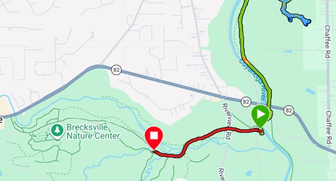
- Finding the Trailhead: Located at Station Road Bridge. 13513 Station Road Bridge, Brecksville, Ohio 44141
Contour Falls Trail Guide
Contour Falls Trail (Cuyahoga Valley National Park)
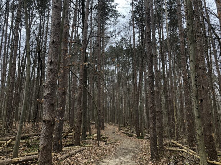
Contour Falls, also known as Cook Falls, is a 5-mile round-trip hike within the Cuyahoga Valley National Park. It is a moderately difficult trail, with approximately 266 feet of elevation gain. It takes hikers on the Towpath Trail and into the “backcountry” of the park, where you will have to climb over and under numerous fallen trees and other physical barriers.
You start your hike by parking at Station Road Bridge in Brecksville, Ohio. While this parking lot is open 24 hours a day, you should only try this hike during daylight.
After departing your car, you will walk on the paved path north until you reach the famous Station Road Bridge within 100 feet.
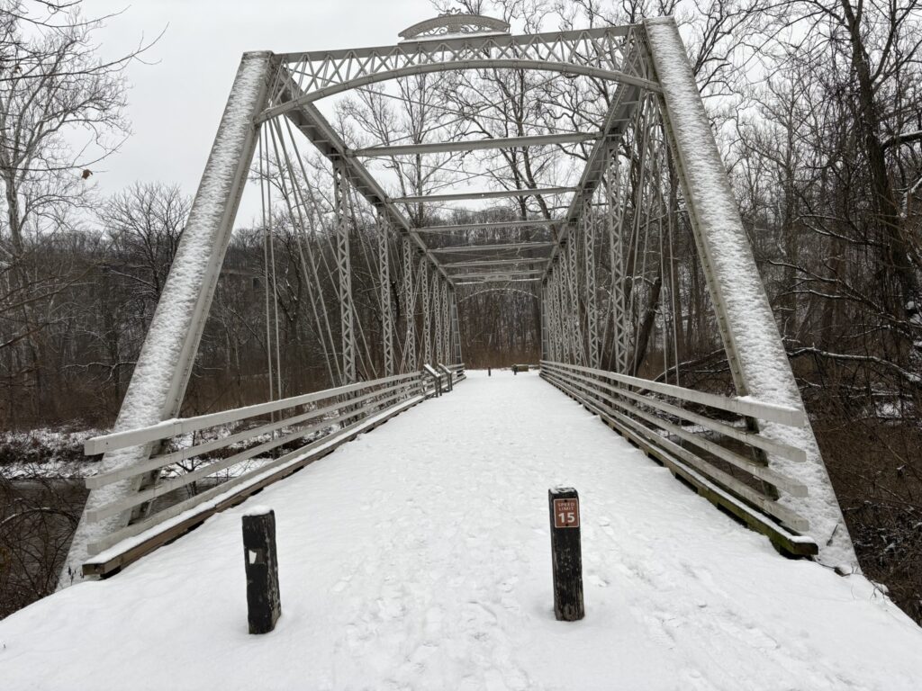
You will cross the bridge and enter the towpath trail, where you will walk straight for about 1/10 of a mile before getting to your first intersection. You will take an immediate left and, within another 100 feet, will come upon a split in the trail. Whether you go right or left, the distance is about the same, and you will merge onto a single trail in about 1/10 mile. Taking a left at the split will bring you closer to the Cuyahoga River, while taking a right will give you better canal views.
Once you complete either the right or left-hand side of the trail, you will continue on the towpath for another 1.2 miles. During this stretch, you will pass Mudcatcher Falls, which is the entrance to Twin Sister Falls. You’ll continue for another 3/4 mile until you see across the canal a creek that carves through the forest. At this point, you will want to cross the canal and begin trekking through the creek.

As you begin hiking through the creek to Contour Falls (Cook Falls), you’ll notice how much different the backcountry of Cuyahoga Valley National Park looks. You will travel through the creek for about a third of a mile, where you’ll have to overcome numerous physical barriers such as large boulders and fallen trees.

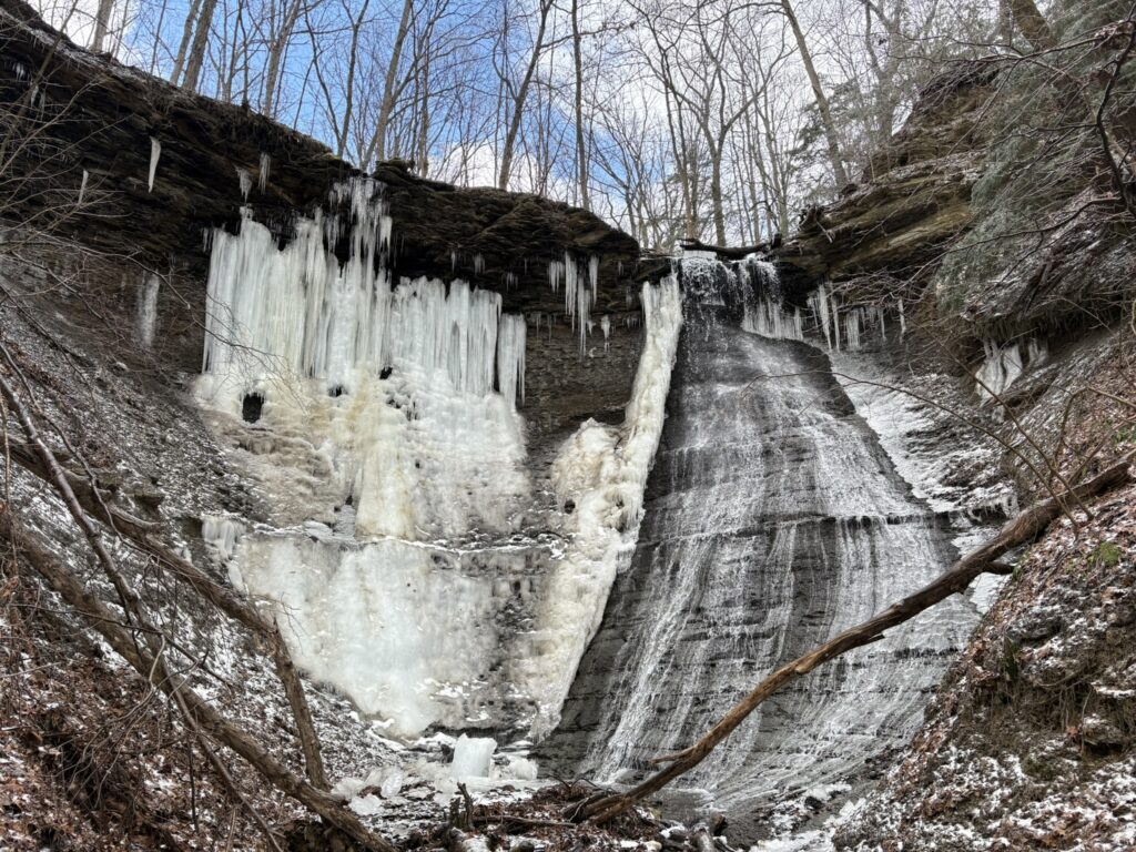
You will quickly come up to a fork in the road. You will want to take the route to the right for 1/2 mile until you reach Contour Falls. On this 1/2 mile section, you will continue to tread through water, over rocks, and under fallen trees. During this section, you’ll also notice the trail splits to the right in 1/4 of a mile. This is not Contour Falls, but it is a great, quick side trip in the winter to witness some amazing frozen waterfall formations.

Whether you decide to take this side trip or not, you will have another 1/4 mile once you reach the part of the creek that goes straight or to the right. Continue straight for 1/4 mile for a relatively easy stretch of the hike until you reach Contour Falls. These falls are amazing in the spring, look unbelievable when frozen, and make a great picnic area or even a relaxing day.

Once you relax, enjoy a snack, and take in the falls, you will head back the same way you came and back to your car in amazement over your adventure.
Alternative Option
If you are looking for a shorter backcountry hike with a bigger waterfall in the same area, then visit Twin Sisters Falls.
Twin Sisters Falls is great because:
- It is half the distance of Contour Falls, with two waterfalls that are almost twice the size!
- It is much safer and easier to reach these waterfalls. Not only that, but it is much more accessible during all four seasons. It also makes this a great kid-friendly hike.
- It is another backcountry waterfall that is essentially a secret, even to most locals. This means you will almost always have it to yourself.
Frequently Asked Questions
You can hike on this trail any time of the year. However, late spring is the prettiest time of year and most accessible.
This hike is considered moderate and achievable for novice to moderately experienced hikers. Expect a trail that consists of limestone, water crossings, stream trekking, and navigating boulders and fallen trees..
Yes, this is a moderate hike for kids eight and up. They will love the waterfall, the streams to play in, and the different plants and animals they may experience.
Yes, you can bring leashed dogs on the trail at any time of the year. Please note your dog with have to navigate boulders and fallen trees.
Contour Falls is commonly known as Cook Falls by locals of the Cuyahoga Valley National Park.
No, this is not a hike that is conducive to trail running.
No, there are no trail markers for Contour Falls. It is best to use the video and the trail map provided map provided in this article.
No, you can hike this trail any day and at any hour. Make sure to be aware of National Park and Private Property boundaries.
This is not a well-known trail in the Cuyahoga Valley National Park, and you should not worry about crowds. Like most trails, you may encounter a few people on the summer weekends.
No, this trail is not recommended for individuals with mobility challenges or physical disabilities.
It is always recommended to carry a phone, backpack, water, waterproof case, hiking boots or shoes, and a light snack. You should also bring a camera for pictures and trekking poles for those who need additional help with balance.
You should park at Station Road Bridge in Brecksville, Ohio.
Contour Falls Trail Map
Driving Directions
The easiest way to get to the Contour Falls Trailhead is to input the Station Road Bridge, Brecksville, Ohio, into your phone and GPS.
Driving Directions:
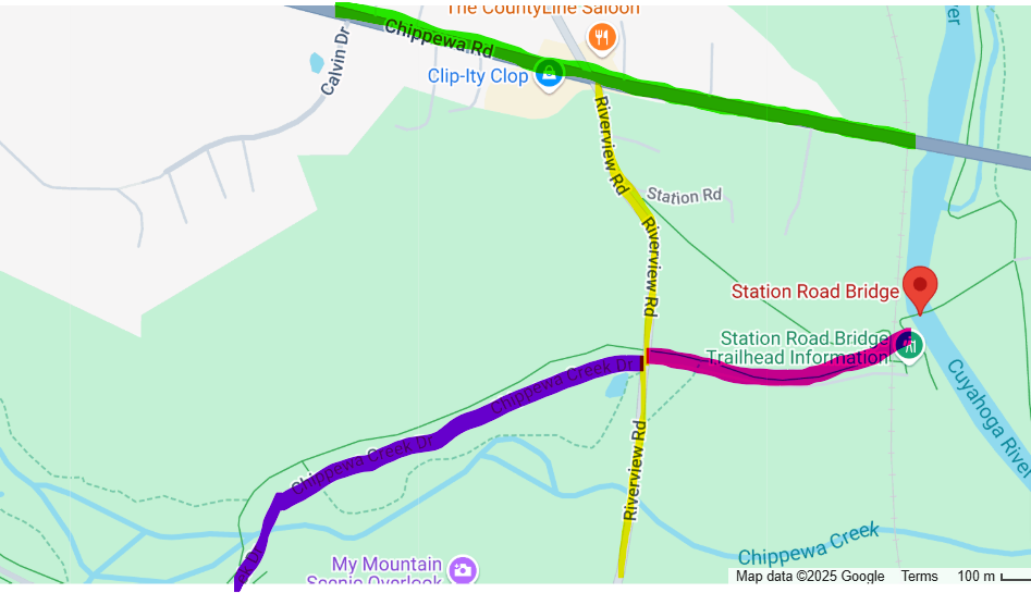
- When driving to the Station Road Bridge Parking Lot, you will arrive from driving north or south on Riverview Road. Once you approach Cuyahoga Valley National Park, you will take a right onto Station Road Bridge Road/Chippewa Creek Road.
Learn More About Cuyahoga Valley National Park Waterfalls
While Contour Falls is one of the best secret backcountry waterfalls in the Cuyahoga Valley National Park, there are so many other waterfalls that can be enjoyed in the same day or over a long weekend in and around the National Park. Check out some of my other favorite waterfalls below:
- Buttermilk Falls
- Brandywine Falls
- Blue Hen Falls
- Chippewa Creek Falls
- Linda Falls
- Bridal Veil Falls
- Great Falls of Tinkers Creek
- Deer Lick Cave Falls


On the hike to Contour Falls once you get to the creek and need to cross the canal how deep is the canal? Are there seasons when the canal is very shallow? Is there a spot along the canal north or south of the creek that typically allows a better canal crossing experience?